Colombia - The lost city
Ciudad Perdida · El Mamey · Santa Marta
Przegląd wycieczki
The Sierra Nevada de Santa Marta is the highest coastal mountain range in the world. The highest point is the Pico Bolivar at 5775m. The Sierra Nevada has different climatic zones: Tropical cloud forest, humid and less humid foothill forests, humid mountain forest, rainy tundra and perpetual snow. This area arouses great interest among scientists and researchers as well as nature lovers, hikers and mountaineers.
In addition to an immense wealth of flora and fauna, this area, which covers 383,000 hectares, is home to various indigenous groups such as the Arhuacos and Kogis. One of the continent's most outstanding archaeological sites can be found here. The "Ciudad Perdida" (lost city) is located at an altitude of 900m-1300m above sea level in the middle of dense jungle. It was probably built by the Tayrona Indians during the 13th and 14th centuries.
The Tayronas had an extraordinary culture due to their socio-cultural system, their highly developed handicrafts and their way of life. Not only is the place itself extraordinary with its terraces, bridges, paths and irrigation canals, but also the way there through various climatic zones is of indescribable scenic beauty.
Plan dzień po dniu
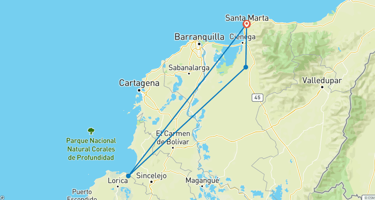
Start of the 5 day/4 night hike to the “Lost City”. You will be picked up from the hotel in Santa Marta at around 8:30 a.m. to 9:00 a.m. The main luggage can be left at the hotel. First about a 2.5 hour drive in 4x4 vehicles from Santa Marta to Mamey and Machette Pelao(about 120 m above sea level) from here the trekking to Adán starts. At our first lunch together, we will briefly go over the next few days before you start your hike from Machete to Camp “Adán”.(about 450m above sea level). When you arrive, you can enjoy a refreshing swim in the natural pools at the camp. Overnight stay in hammocks or double bunk beds.
Camp Adan
3-4h / 9km / ▲600m ▼300m