Hiking on the Dachstein Circuit
Guttenberghaus · Türlwand · Dachstein Ice Caves
Przegląd wycieczki
Hut hikes around the mighty Dachstein
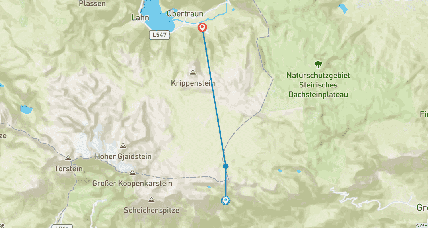
The Dachstein hut circuit is a challenging hut hike in alpine terrain that connects the Austriahütte, Guttenberghaus, Simonyhütte and the Adamekhütte. It takes you through very varied landscapes and passes along fields of mountain pines beneath mighty rocky peaks close to the glacier world of the Dachstein without having to step onto one of the numerous glaciers. There are several glaciers on the Dachstein, the largest of which are: the Hallstatt Glacier to the north-east of the summit, the Schladming Glacier to the east and the Great and Small Gosau Glaciers to the north-west.
On the second day, we head over the Edelgries into the "glacier world" of the Dachstein. From here, the route continues over a huge rocky landscape to the Guttenberghaus. The next stage to the Simonyhütte is less steep, crosses the Dachstein plateau and is dominated by mountain pines and breathtaking views. On the fourth day, you are once again out and about in rugged rocky terrain. On the last stage back to the Austriahütte, you leave the alpine world and head back to the starting point of your Dachstein hut tour below the mighty south face of the Dachstein.
Your experiences
- Magnificent views of the glaciated high mountain world
- Through green mountain pine forests on the Dachstein plateau
- Rope-insured embrasures between imposing rock needles
- Circumnavigate the mighty Dachstein massif
Profile
- Individual trekking tour at your own pace
- 4 challenging hikes on the Dachstein hut circuit
- Overnight stays in mountain huts
- Without luggage transport
Requirements
This tour on the Dachstein hut circuit "counter-clockwise" is a challenging mountain tour for experienced mountain hikers. The route is divided into 4 stages over a good 40 kilometers and you cover around 3,000 meters in altitude. You have to master ascents of up to 1,000 meters in altitude, descents of up to 1,400 meters in altitude and walking distances of up to 15 km. The route leads through alpine terrain with snowfields or slippery scree. Several sections are secured with wire ropes and iron ladders. You should therefore have mountain hiking experience. Sure-footedness and a head for heights are essential. As this is an individual tour, you should also be able to use a hiking map and find your way around.
Tips: You can take a via ferrata set with you if you feel more comfortable on the ropes. Grödeln/light crampons are recommended at the beginning and end of the season.
Maps: Current AV maps of the region: 14 Dachstein mountains
Level of difficulty
- Fitness: difficult
- Technique: difficult
Plan dzień po dniu
An easy path leads from the parking lot to your first accommodation, the Austriahütte, in about 30 minutes.
- Accommodation: Austriahütte
- Meals: Dinner
Tour requirements
This tour on the Dachstein hut circuit "counter-clockwise" is a challenging mountain tour for experienced mountain hikers. The route is divided into 4 stages over a good 40 kilometers and you cover around 3,000 meters in altitude. You have to master ascents of up to 1,000 meters in altitude, descents of up to 1,400 meters in altitude and walking distances of up to 15 km. The route leads through alpine terrain with snowfields or slippery scree. Several sections are secured with wire ropes and iron steps. You should therefore have mountain hiking experience. Sure-footedness and a head for heights are essential. As this is an individual tour, you should also be able to use a hiking map and find your way around.
Tips: Think of cash for the additional costs at the huts and, if necessary, for buying your snack for lunch, which you should take with you for the long daily stages in the morning at the huts.
Notes: Mostly shared rooms are reserved. However, the allocation in the hut is the responsibility of the hut warden and depends on the current occupancy rate.
Hints: You can take a via ferrata set with you if you feel more comfortable on the ropes. Grödeln/light crampons are recommended at the beginning and end of the season.
Maps: Current AV maps of the region: 14 Dachstein mountains
- Fitness level: difficult
- Technique: difficult